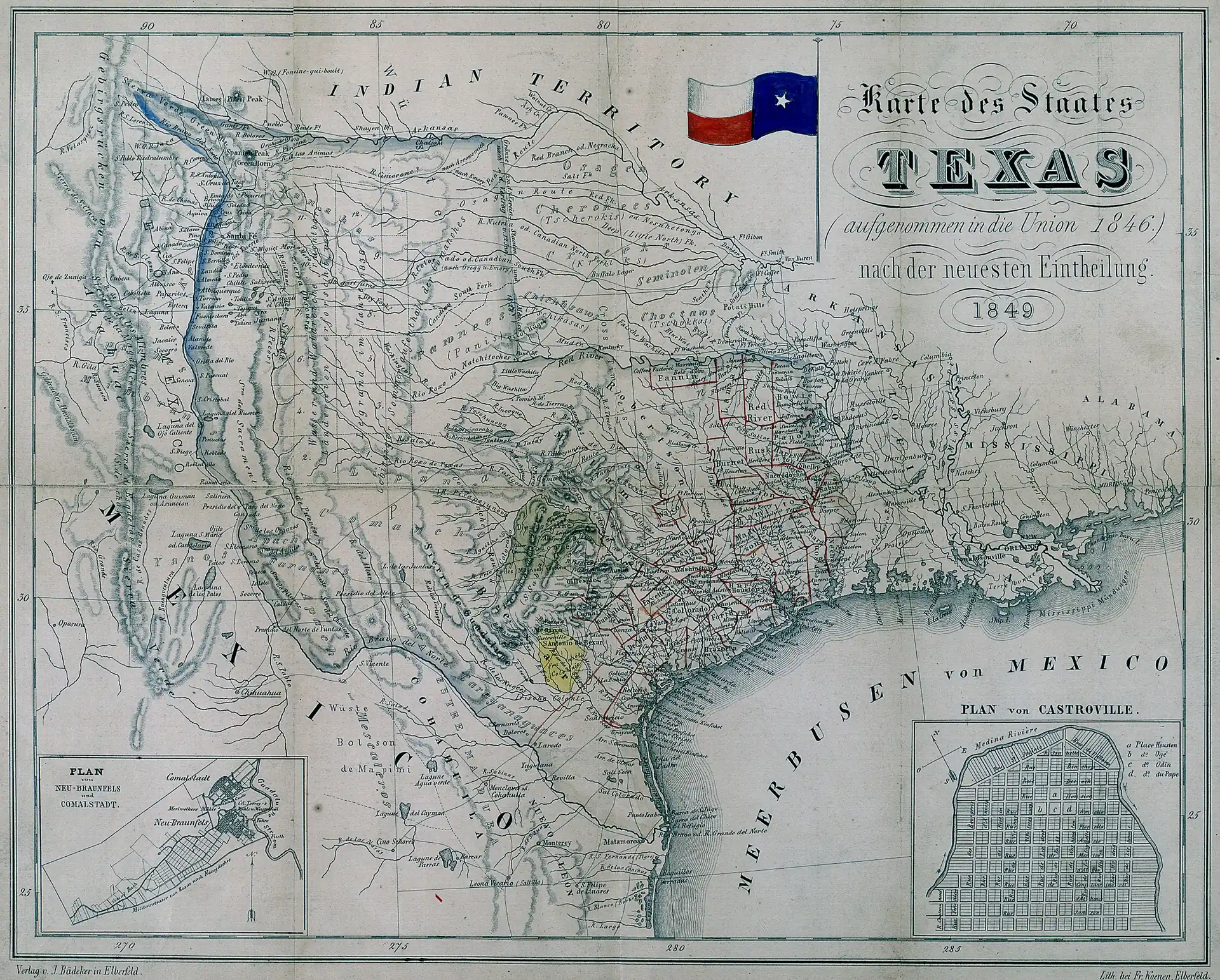
The ink was barely dry on Texas statehood when a publisher in Elberfeld, Germany started selling maps of the place.
J. Bädeker's 1849 Karte des Staates Texas — "Map of the State of Texas" — is one of the more quietly remarkable documents to survive from that period — not because it's the most detailed map Texas ever produced, but because of what it represents: a European commercial interest in a place that had only been an American state for four years, printed in German for an audience that was, at that exact moment, pouring into Texas by the thousands.
The map is held today in the collections of the University of Texas at Arlington Libraries, which contributed it to Wikimedia Commons.
Why a German Publisher Was Watching Texas Closely
To understand why Bädeker published this map in 1849, you have to understand what was happening in Germany — and in Texas — simultaneously.
The late 1840s were a period of revolutionary upheaval across the German states. The revolutions of 1848 failed. Political refugees, called the Forty-Eighters, fled westward. But even before that wave, a deliberate, organized German immigration to Texas had been underway since 1844, when the Adelsverein — the Society for the Protection of German Immigrants in Texas — began actively recruiting settlers. By 1846, New Braunfels and Fredericksburg had been established. By the time Bädeker published his map, tens of thousands of German-speaking immigrants had already arrived or were actively planning to.
A commercial map of Texas, printed in German, sold in Germany, was no academic exercise. It was a literal lifeline — a practical blueprint for families trying to figure out exactly where across the ocean they were going to drop anchor.
What the Map Shows — and What Texas Looked Like in 1849
By 1849, the eastern counties and coastal settlements were reasonably well documented. San Antonio, Galveston, Houston, Austin — these appear with confidence on maps from this era. The road networks between them show up too.
The boundary of Anglo-American settlement in 1849 ran roughly through a line from San Antonio to Austin to Waco. West of that, cartographers were working from military survey data and a fair amount of informed guesswork. The Comanche and Kiowa held that territory in practical terms, regardless of what any map said about Texas state lines.
German Texas Is an Underappreciated Thread in This State's Story
Most people know, at some level, that Texas has German heritage. Oktoberfest in Fredericksburg, the German-language newspapers that ran in San Antonio well into the 20th century, the kolaches that dot the I-35 corridor — these things have become cultural shorthand.
But the depth of that influence is something else. During the Civil War, the German Hill Country communities were disproportionately Unionist, leading to real violence — the Nueces Massacre of 1862, in which Confederate forces killed thirty-four German Unionists near the Nueces River, is a chapter that doesn't get nearly enough attention. The Comfort, Texas monument Treue der Union — "Loyalty to the Union" — is one of very few Civil War monuments in the South honoring Union dead.
A map like Bädeker's 1849 Karte des Staates Texas sits at the front end of all of that history. It's not just a geographic document. It's evidence of a community preparing to cross an ocean and build something.
Do you have German heritage connected to the Texas Hill Country settlements? We'd love to hear which community your family came to — New Braunfels, Fredericksburg, Comfort, or elsewhere — and whether any family documents or photographs from that era survived the journey.




No comments yet