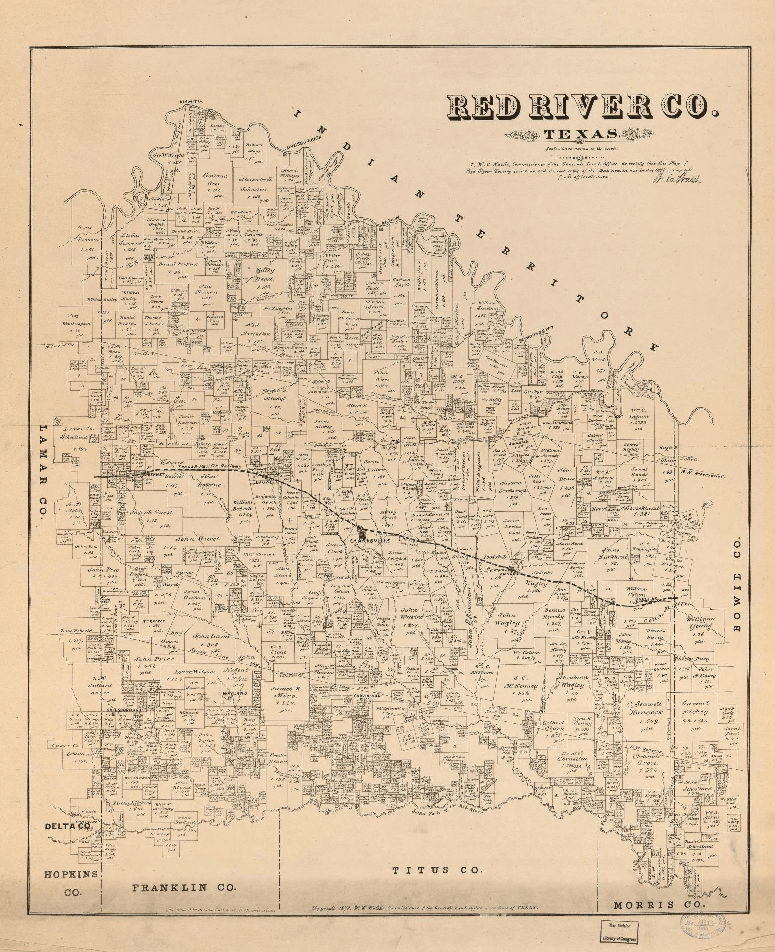
This stunning 1879 survey map of Red River County, Texas is a snapshot of a world being carved out parcel by parcel. Certified by W.C. Walsh, Commissioner of the General Land Office and lithographed by August Gast & Co., this map documents individual land grants with the owner’s name and acreage recorded right on the plat — hundreds of them, packed edge to edge.
Look closely and you can trace the Texas Pacific Railway cutting across the county, the town of Clarksville anchoring the heart of the map, and smaller communities like Wayland, Jonesborough, and Hallsborough scattered across the landscape. To the north, the Red River marks the boundary with Indian Territory — a reminder of just how close the Texas frontier still was in 1879.
Neighboring counties — Lamar, Bowie, Titus, Morris, Franklin, Hopkins, and Delta — frame a county that was already densely settled, with family names filling nearly every surveyed tract. These weren’t just property lines. They were lives, legacies, and hard-won land.
What family names do you recognize on this map? Drop them in the comments! 👇

No comments yet