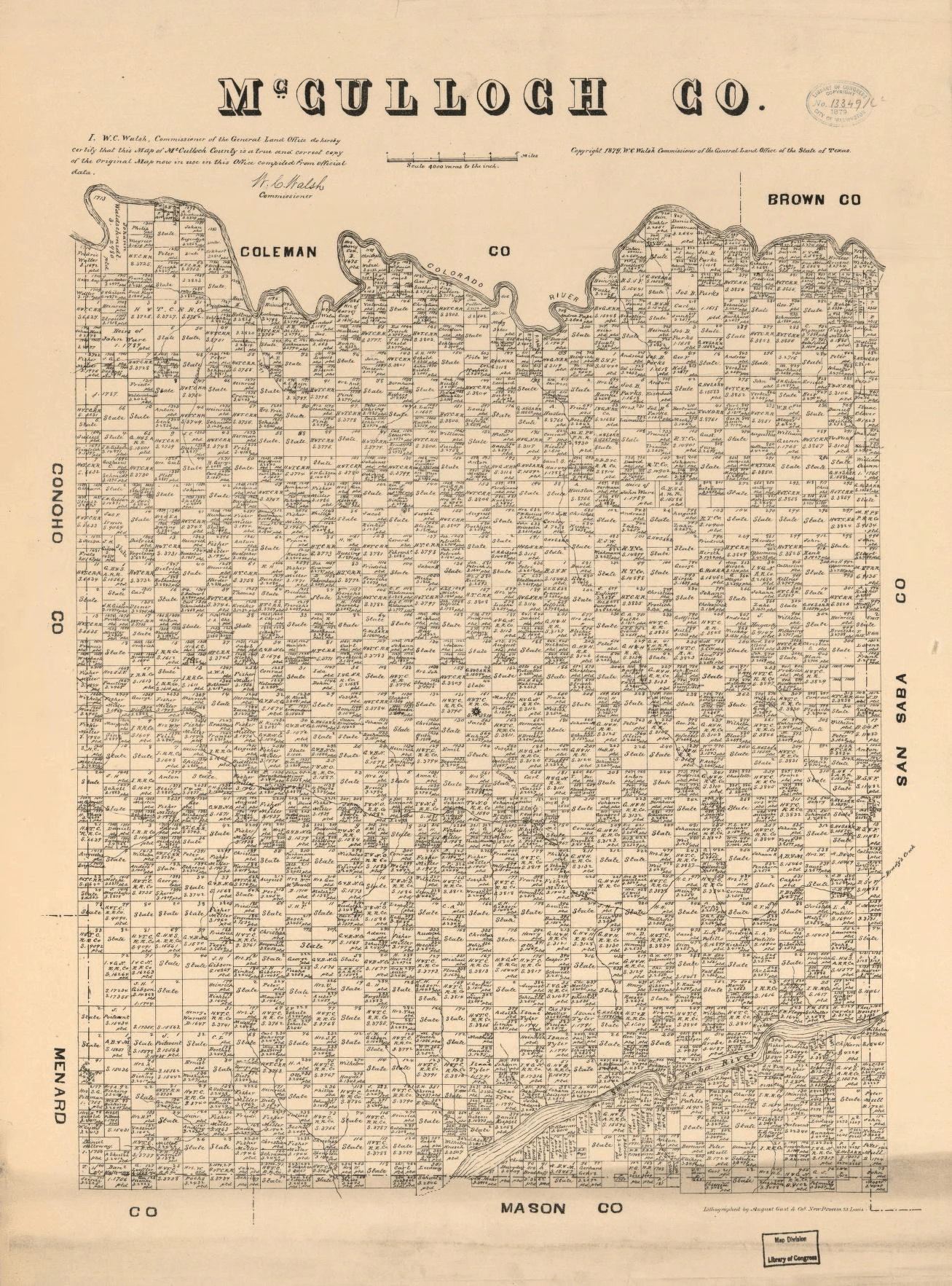
Long before Brady became the heart of McCulloch County, every acre of this Central Texas land had to be surveyed, certified, and claimed — and this remarkable 1879 map tells that story in extraordinary detail. 📜
This official land survey map was personally certified by W.C. Walsh, Commissioner of the Texas General Land Office, as a true and correct copy compiled from official data. Walsh, who served the GLO from the post-Reconstruction era well into the early 20th century, oversaw some of the most consequential land documentation in Texas history.
Look closely and you can trace the Colorado River winding along the northern boundary, separating McCulloch from Coleman and Brown counties. Every grid square represents individual land grants and survey blocks, many still marked simply as “State” — land not yet claimed or transferred into private hands at the time of printing. 🌾
The county sits at the crossroads of some fascinating Texas territory, bordered by Coleman to the north, Brown to the northeast, San Saba to the east, Mason to the south, Menard to the southwest, and Concho to the west — a true slice of the Texas Hill Country frontier.
The map was lithographed by August Gast & Co. of St. Louis, one of the premier map and lithography firms of the era, lending it the fine detail and print quality that allowed it to survive all these years.
If your family roots run through McCulloch County, maps like this one are gold for tracing original land ownership. 🤠 Drop a comment if your ancestors appear in this county’s early history!
No comments yet